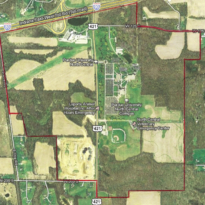
The service coverage area surrounding the Purdue University Northwest – North Central campus, generally centered along U.S. Highway 421 in the Westville, Indiana area.
The northern boundary runs along the Indiana Toll Road (I-80/90), extending east–west just above the campus. From there, the coverage area stretches east along W 125 S.
The eastern boundary extends south past the campus area, encompassing agricultural land and portions of the surrounding countryside. The boundary then curves westward along W 200 S.
On the western side, the boundary runs north along local roads west of U.S. 421, enclosing a mix of farmland, wooded areas, and scattered residential properties.
Overall, the coverage area includes:
- Purdue University Northwest, Westville Campas
- The Fields of New Durham
- Univertisty Village
- TP Orthodontics, Inc